
 E-Paper



Heatwave conditions won’t set in till May 18: IMD
A fresh western disturbance is likely to affect western Himalayan region and plains of northwest India from May 11 onwards.

 Prefer HTon Google


An unusually high number of western disturbances (WD) in March, April and now in May has subdued the searing heat normally felt in April and May, the India Meteorological Department (IMD) has said, adding that similar conditions are likely to persist till around May 18.
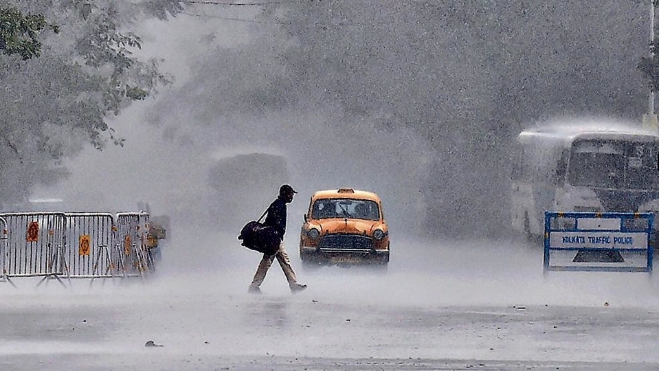
“There was no heatwave in May till now. We are not expecting heatwave conditions to set in till May 18. On May 10, 11 and 12, rain and thunderstorms are likely over northwest India under the influence of an intense western disturbance. It has rained almost continuously in many parts of the country in April. There were cloudy skies and strong winds over north India also, which didn’t allow the maximum temperatures to rise. In central and peninsular India, there is wind discontinuity which is bringing intermittent thunderstorm activity and cool winds,” RK Jenamani, senior scientist, national weather forecasting centre, said.
There were seven western disturbances which moved across western Himalayan region in March against the normal of four WDs. Of these, three were very active, bringing rainfall, snowfall and thunderstorm to the region. April saw nine WDs move across western Himalayan region against the normal of four to five WDs. Four of them were active and moved as cyclonic circulations, bringing rain and thunderstorms to the hills and plains. There were two WDs in May and another expected to impact the region from Tuesday.
In March, severe heatwave was recorded over west Rajasthan and heatwave conditions over east Rajasthan, Odisha, Gangetic West Bengal, coastal Andhra Pradesh and Tamil Nadu. In April, however, the heatwave was occasional and for shorter periods over smaller pockets. This is mainly because of wet spells over the western Himalayan region and adjoining plains of northwest India and central India on many days due to the movement of WDs. No heatwave was recorded in May, according to the weather body.
Jenamani added that with the likely arrival of monsoon over Kerala on June 1, further heatwave conditions are unlikely over Peninsular India. “Over north India, May-end and beginning of June can be very hot. But we can’t tell now. It depends on what weather systems develop.”
The average maximum, minimum and mean temperature in April was 34.52 degree C, 22.33 degree C and 28.42 degree C, respectively, against the normal of 33.94 degree C, 22.15 degree C and 28.04 degree C based on the average for 1981-2010 period.
In March, the maximum, minimum and mean temperature was 32.65 degree C, 19.95 degree C and 26.30 degree C, respectively, against the normal of 31.24 degree C, 18.87 degree C and 25.06 degree C.
A fresh western disturbance is likely to affect western Himalayan region and plains of northwest India from May 11 onwards. Under the influence of this WD and its interaction with easterly winds and moisture feed from Arabian Sea, fairly widespread rainfall or thundershowers are very likely over western Himalayan region and isolated rainfall/thunderstorms is likely over plains of northwest India on May 11 and 12 with maximum intensity on May 12 and 13. Isolated heavy rainfall is also likely over Himachal Pradesh and Uttarakhand on May 12 and 13.
Under the influence of strengthening of lower level south-westerly winds and its confluence with lower-level westerlies, fairly widespread rainfall/thunderstorm activity is also likely over northeastern states and West Bengal; and scattered rain/thundershower over remaining parts of east India during the next four to five days.
Due to a north-south trough (area of low pressure)/wind discontinuity from southwest Madhya Pradesh to Karnataka coast, light/moderate rain/thunder is very likely over Kerala, Mahe, Lakshadweep and Karnataka and isolated rain over rest of south Peninsular India during the next four to five days. No heatwave conditions are likely over any part of the country during this period.


