
 E-Paper



Heavy rain continues in Telangana for fifth day
IMD predicted that a fresh low-pressure area is likely to form over north-west and adjoining west-central Bay of Bengal around July 24.


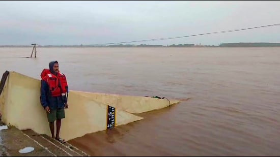
Heavy rains continued to pound different parts of Telangana for the fifth consecutive day on Saturday, resulting in overflowing of lakes, tanks and other water bodies, while Godavari river continued to be in spate, officials familiar with the matter said.
According to a weather bulletin from Telangana State Development Planning Society, the state witnessed heavy rains in northern Telangana districts, with Sirpur (U) in Kumaram Bheem district recording the maximum rainfall of 231.5 mm till 8.30 am on Saturday.
Also Read | Rain intensity to come down in city, says IMD
It was followed by 224.8 mm at Kaddam Peddur in Nirmal district, 154.3 mm at Pembi in Nirmal district and 140.0 mm at Jainoor in Kumaram Bheem district. Very heavy rainfall ranging from 115.6 mm to 204.4 mm was witnessed at isolated places in Adilabad, Kumaram Bheem, Nirmal and Jagitial districts, the bulletin added.
Similarly, heavy rainfall ranging from 64.5 mm to 115.5 mm was recorded at isolated places over Adilabad, Kumuram Bheem, Nirmal, Nizamabad, Jagtial and Karimnagar districts.
The average cumulative rainfall in the state since the commencement of the season on June 1 is 349.0 mm as against the normal of 282.9 mm with deviation of 23%.
Also Read | Junagadh flood: Orange alert in Gujarat for next 2 days, heavy rain likely
The low-pressure area over South Odisha–North Andhra Pradesh and adjoining regions has become less marked. The India Meteorological Department (IMD), Hyderabad, predicted that a fresh low-pressure area is likely to form over north-west and adjoining west-central Bay of Bengal around July 24, and there is a moderate probability that it will further intensify into a depression in the subsequent two days.
It also predicted light to moderate rains and thundershowers at many places with heavy rain at isolated places in the next three days.
The agency also advised people to keep a watch on the weather and move to safer places to protect themselves from lightning strikes.
An irrigation department official said projects in Godavari basin were receiving huge inflows from upstream. At Kadem project in Nirmal district, the water level has risen to 688.22 feet against a maximum level of 700 feet, forcing the authorities to open 14 gates of the project to release 84,269 cusecs of water.
Similarly, Sri Ram Sagar Project (SRSP) on Godavari river also continued to receive massive inflows. The current water level in the project is 1,079.10 feet against full level of 1,091 feet. If the current inflows continue for 2-3 days, the project’s gates will have to be opened, the official said.
Meanwhile, the water level of Godavari river receded to 39.4 feet at Bhadrachalam in Bhadradri Kothagudem district on Saturday morning.
The district administration withdrew the first danger signal given at 43 feet. However, with projects upstream getting huge inflows from neighbouring Maharashtra, the water level is likely to rise again, the official added.


