
 E-Paper



World Bank flags Mumbai flood zones where rents are 25% lower; Delhi leads in river flood exposure
Mumbai Rains: A World Bank report has flagged parts of the financial capital as coastal flooding hotspots, where rents are 20–25% lower

 Prefer HTon Google


The World Bank’s report Towards Resilient and Prosperous Cities in India has identified a few areas in Mumbai as coastal flooding hotspots, warning that rising sea levels could severely impact coastal cities by 2100.
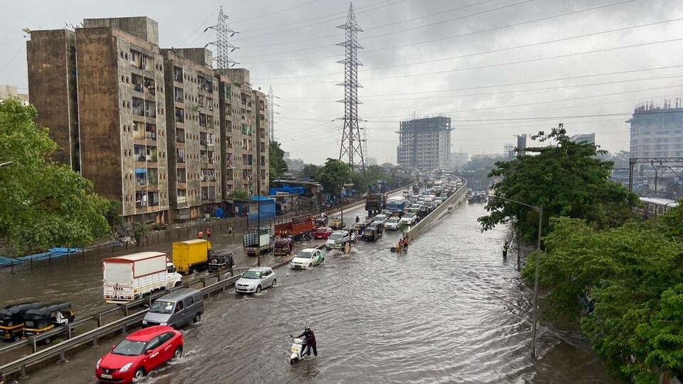
The report highlights that affordable housing and proximity to jobs often compel the urban poor to settle in high flood-risk zones. In Mumbai, for instance, rents in such vulnerable areas are typically 20–25% lower than the city average.
Delhi has the largest built-up areas exposed to river-related flooding, the report noted.
Mumbai, Surat and Kolkata most affected cities
According to the World Bank report, Mumbai, Kolkata, and Surat are likely to be among the most affected Indian cities due to rising sea levels. In Greater Mumbai, southern parts could face regular flooding or be surrounded by water during high tides, while sea water may also seep into new settlements in Navi Mumbai and northern suburbs through natural waterways.
Even without any expansion beyond 2015 boundaries, Greater Mumbai could have 210 sq km of exposed settlements by 2100, the highest among Indian cities. Kolkata shows a similar, though smaller-scale, risk pattern. In Surat, the newer built-up areas on the western side are most vulnerable, the report notes.
The report, citing Aqueduct, a global flood analyzer, warns that the annual cost of coastal flooding in urban areas could surge from $2.4 billion in 2010 to $21 billion by 2030, and a staggering $75 billion by 2050 if no preventive action is taken.
Also Read: Flood and heatwave risks increasing in urban India, $2.4 trillion investment required: World Bank
Coastal flooding explained
According to the report, storm surges and tropical cyclones can cause sharp rises in sea levels, triggering severe coastal flooding in urban areas. India is particularly vulnerable to such events, especially during the monsoon season from June to October. On average, two to four tropical cyclones affect the country each year, with states like West Bengal, Odisha, Andhra Pradesh, and Tamil Nadu being the worst hit. The Bay of Bengal, one of the most cyclone-prone regions globally, sees five to six tropical cyclones annually.
Of India’s 7,500 km coastline, around 5,700 km are exposed to intense cyclones and flooding. Notably, 40% of the country’s population lives within 100 km of the coast, predominantly in densely populated urban areas.
The report highlights that West Bengal faces the highest risk of mortality and damage in built-up areas due to coastal flooding, largely because of the extreme population density in and around Kolkata, where settlements are vulnerable to both coastal and pluvial (rain-related) flooding.
Also Read: Mumbai Rains: Housing transactions impacted as homebuyers’ walk-ins slow down during monsoon
Urban expansion has altered the flood risk profile
According to the report, urban expansion has significantly altered the flood risk profile of many areas, placing more than two-thirds of the urban population at risk. India’s numerous coastal cities and those located along major river floodplains are particularly vulnerable. As urbanisation increases surface impermeability, even areas once considered low-risk are now experiencing frequent flooding. This includes cities situated in the upper parts of watersheds, such as Bengaluru, Hyderabad, and Indore.
Delhi has the largest built-up areas exposed to river-related flooding
According to the report, built-up areas exposed to fluvial (river-related) flooding in selected Indian cities nearly doubled between 1985 and 2015, reaching 1,683 sq km by 2015. This trend is especially evident in cities with previously low flood risk or those located in upper watersheds such as Hyderabad, Bengaluru, and Indore which now face frequent flash floods.
In riverine cities, urban expansion on both sides of rivers enabled by modern bridge infrastructure has significantly increased flood exposure. In large cities like Delhi and Surat, embankments have been constructed to contain river flow. However, while these may reduce local flooding, they can increase flood heights downstream, the report noted.
Among the cities analysed, Delhi has the largest built-up area exposed to fluvial flooding, the report noted.
Does coastal flooding impact rentals?
Coastal and pluvial flooding significantly impact rental patterns, particularly for the urban poor. According to the report, pluvial flood zones, typically found in low-lying, poorly drained areas, are often where low-income populations reside. Global data suggests that affordability and proximity to jobs drive the urban poor to settle in high flood-risk zones despite the hazards.
Also Read: Mumbai Rains: How waterlogging and flooding impact the financial capital’s property market
In Mumbai, for instance, rents in flood-prone areas are 20%–25% lower than the city average. Similarly, in Kolkata, two of the three most flood-prone boroughs within the Kolkata Municipal Corporation (KMC) area are home to over 50% of the city’s urban poor, highlighting how vulnerability and affordability are closely linked, the report noted.


