E-Paper


Nor’easter map, tracker and power outage updates for Massachusetts, Maine, Rhode Island, New Hampshire, Maryland and NC
A powerful nor'easter is battering the East Coast with flooding, high winds and power outages, and here's a full tracker of the storm's impact.

 Prefer HTon Google


A powerful nor’easter is bringing heavy rain, strong winds, coastal flooding and power outages across parts of the US East Coast this weekend. Coastal areas from North Carolina to Maine are seeing some of the biggest impacts, with flooding, rough surf and travel disruptions.
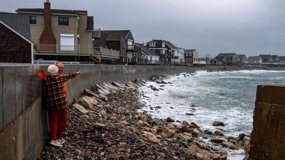
The storm is also affecting Massachusetts, Maine and Rhode Island, while New Hampshire, Maryland and North Carolina are among the states in the storm’s wider path, according to Fox17.
Massachusetts
Roughly 6,000 customers were without power across Massachusetts as of Saturday at 2:45pm, according to the Massachusetts Emergency Management Agency (MEMA) outage map.
Deep Dive

In Scituate, town officials are bracing for outages that could last several days. "We're starting to see the storm that was forecast with those really high winds," Scituate Town Manager Jim Boudreau told CBS News. "It's going to get a little worse before it gets better."
Boudreau said the storm's length could delay power restoration until Monday. "If you lose power, you probably won't see a truck until Monday because it's just too dangerous for those guys to come up in the trucks," he said. The town plans to open a building on Sunday so residents can charge devices if outages are widespread, and Boudreau is urging residents to stay indoors unless necessary. The town has added extra first responders and deployed high-water safety vehicles as a precaution. New seawalls installed in Scituate in recent weeks, some still under construction, are also being tested by the storm. "This is the first time [the new seawall] has really gotten hit, so far so good," Boudreau said.
Maine
In Maine, the nor'easter is bringing high surf, gusty winds and periods of rain, though the storm is tracking farther southwest, according to WMTW. A High Surf Advisory is in effect until 8pm Sunday, and a Coastal Flood Advisory is active from 10am Saturday through 11pm Sunday local time.
Wind gusts of up to 45 mph are possible, especially in southern Maine. Northeast winds of 25 to 30 mph are expected through the weekend. Seas have already reached 8 to 12 feet, bringing dangerous waves near the coast and a high risk of rip currents. Seas could rise to 15 to 17 feet late Saturday afternoon.
A coastal flood advisory is in effect for York County, where storm surge could reach 1 to 2 feet. This is mostly expected to cause water to splash over coastal areas rather than major flooding. Some parts of York County could get 2 to 4 inches of rain over the next few days. The Midcoast could receive 1.5 to 2.5 inches, while the foothills could get 0.5 to 1.5 inches.
Showers and dangerous conditions at sea could continue into Tuesday, as per WMTW.
Also read: When will El Nino hit Texas? November and December winter weather forecast for Dallas-Fort Worth
Rhode Island
Video from WJAR showed waves pounding the shore at Narragansett Town Beach in Rhode Island, as the storm brought severe flooding risk across Southern New England. Wind gusts along parts of Rhode Island could reach up to 60 mph, per the National Weather Service.
New Hampshire and Maryland
New Hampshire is among the states in the storm's path, with rain and strong winds forecast from Virginia to Maine. Nearly 100,000 customers were without power across New Jersey, New York, Connecticut and Massachusetts on Saturday morning.
Maryland is also in the storm's path, with rain and strong winds forecast to affect the state as the nor'easter moves along the coast from Virginia to Maine, according to Fox17.
North Carolina
North Carolina marks the southern edge of the storm's reach, with the nor'easter bringing flooding, power outages, heavy rain, high surf and damaging winds “from North Carolina to Maine,” as per Fox17.
Residents can check and map and tracker here.
Residents can check the power outage map here.
Wider storm impact
New Jersey roads flooded in several areas, including Long Beach Island, where water covered streets and yards during high tide. Mikie Sherrill declared a state of emergency in eight counties, including Ocean County.
New York also declared emergencies in coastal areas, and officials warned of wind gusts up to 55 mph over the weekend, which could bring down trees and power lines.
Saturday's full moon was expected to worsen coastal flooding further.
More than 1,100 flights have been delayed and another 400 grounded.