
 E-Paper



After short breather, air quality returns to poor in Chandigarh
With a fresh Western Disturbance affecting Chandigarh from Wednesday night, its effect was seen on the city’s air quality


After staying in the moderate bracket (101-200) on Monday and Tuesday, the Air Quality Index (AQI) returned to poor category (201-300) on Wednesday. Southern parts of the city were the first to be affected, but the air quality turned poor in the rest of the city later.
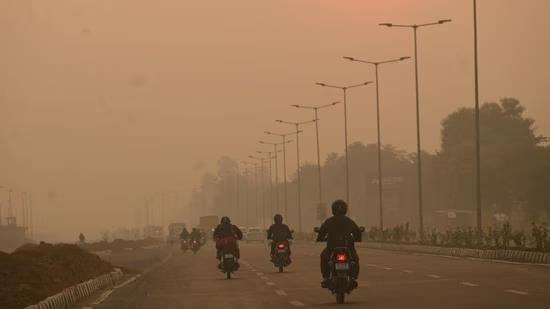
AQI was the worst at the Continuous Ambient Air Quality Monitoring Station (CAAQMS) in Sector 25, where it stayed over 200 since morning and shot up to 225 around 8 pm. While the CAAQMS in Sector 22 stayed below 200 till evening, it also went up to 203 at 8 pm.
The Sector 25 CAAQMS, which is in the city’s periphery, has yet to record an over 200 AQI this season. Panchkula also continued to have cleaner air than Chandigarh, with an AQI of 133 at the Haryana Pollution State Control Board observatory in Sector 6, Panchkula.
Between 201 and 300, AQI can cause breathing discomfort to most people on prolonged exposure. AQI between 101 and 200 can also cause breathing discomfort to people with lungs and heart diseases.
Speaking about why the AQI has gone up, India Meteorological Department (IMD) Chandigarh director Manmohan Singh said this was directly related to the fresh WD. “Due to the WD, the dominant wind affecting the region has shifted and pollutants being blown towards the Gangetic plains are coming towards this region. This effect can continue for the next few days.”
Chances of light rain today
Due to the WD, there is a chance of light rain in the city on Thursday, as per Singh. “The WD isn’t very strong, but even a drizzle can improve the air quality. On the flip side, shallow fog may start forming after the WD passes around November 10. The temperature is also likely to start dropping around then,” he added.
On Wednesday, the maximum temperature rose from 28.6°C on Tuesday to 30°C, two degrees above normal. The minimum temperature also increased from 12.7°C to 13.6°C, normal for this time of the year.
Over the next three days, the maximum temperature will remain between 25°C and 29°C, and minimum temperature between 15°C and 16°C.


