
 E-Paper



Another monsoon over, Punjab still lacks floodplain mapping
Punjab government tells NGT geospatial data for scientific demarcation of floodplains still awaited from Survey of India

 Prefer HTon Google


Having failed to complete the scientific demarcation of its vulnerable floodplains even as another monsoon has gone by, the Punjab government has sought yet another extension from the National Green Tribunal (NGT) to complete the exercise.
In its second status report, filed in compliance with the NGT’s July 30 order, the state water resources department said technical issues had necessitated fresh drone mapping of approximately 41 sq km in the Harike area.
But the Survey of India had missed the September 30 deadline to submit the remaining geospatial data, which was now expected by October 31, Krishan Kumar, principal secretary, water resources, informed the tribunal through an affidavit on October 9.
The Survey of India is the central engineering, surveying and mapping agency of the Government of India.The latest delay comes despite the state’s October 2025 assurance that the scientific survey will be completed within 10 months, by August 2026.
With the monsoon having ended in the last week of September, the continued delay raises questions about Punjab’s preparedness to identify flood-prone areas along the Sutlej, Beas and Ravi rivers, and plan long-term mitigation measures before the next rainy season.
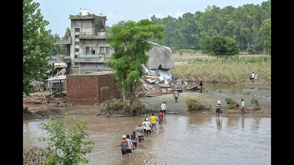
The urgency is underscored by the devastating floods of August and September 2025, when exceptionally heavy rainfall, overflowing rivers and breached embankments inundated hundreds of villages and thousands of acres of farmland. The disaster claimed lives, displaced residents and damaged roads, bridges, agricultural land and public infrastructure, with losses estimated at nearly ₹13,000 crore.
Scientific floodplain demarcation uses high-resolution satellite and drone imagery, digital terrain models and computer-based hydraulic simulations to identify areas susceptible to inundation. The exercise is intended to help authorities assess flood risks, regulate development in vulnerable areas and strengthen disaster preparedness.
The matter is being heard in an original application filed by Karnvir Thamman, a social activist from Banur, Mohali. During the April 15, 2026, hearing, the NGT had pulled up the Punjab government for failing to provide either the progress achieved or a firm timeline for completion.
Major mapping work pending
The figures submitted to the tribunal indicate that significant portions of the mapping work have yet to be completed. Against Harike’s revised total area of 475.42 sq km, ortho-rectified imagery (ORI) has been generated for 364.93 sq km, while digital terrain modelling (DTM) covers only 43.63 sq km. Drone surveys have covered 422.84 sq km.
At Nangal, where the revised area is 1,292.90 sq km, ORI mapping covers 1,170.75 sq km and DTM work 809.55 sq km. Although drone flying has been completed across the revised area, the geospatial datasets remain incomplete.
Another 60 days after data submission
Meanwhile, the state has awarded the floodplain-zoning contract to Geo Climate Risk Solution Pvt Ltd, issuing the letter of acceptance on September 28. However, the agency’s 60-day deadline will begin only after it receives the complete dataset from the Survey of India.
The zoning exercise will use the HEC-RAS hydraulic model and take into account the highest flood level recorded over a 100-year period. October 31, therefore, is only the revised target for submission of the remaining data for Harike, not the deadline for completing the entire exercise. Hence, Punjab’s floodplain demarcation is set to stretch months beyond the August 2026 deadline promised by the state government.


