
 E-Paper



No fog in Chandigarh, thanks to north-westerly winds
Scientist at the IMD, Chandigarh, Shivinder Singh said, “Chandigarh has more effect of north westerly winds than the adjoining areas because of its position at the foothills of the Himalayas. For dense fog, even a little wind can keep fog from forming which is what has happened here”


While adjoining areas of Punjab and Haryana continue to have dense fog, Chandigarh has only seen shallow fog in the season till now because of the effect of north-westerly winds as per the India meteorological department (IMD). This can change in the coming days and moderate fog is expected in the city from Wednesday onwards.
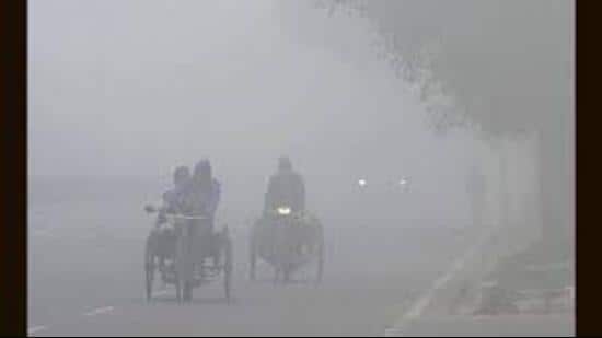
In Chandigarh, visibility dropped down to 800 meters at 5.30 am. When visibility is between 500-1,000 meters it is classified as shallow fog by the IMD. It further improved to 2,500 meters at 8.30 am. In other places, at 8.30 am, the visibility was less than 50 meters at Patiala, Ludhiana, Ambala and Karnal.
Scientist at the IMD, Chandigarh, Shivinder Singh said, “Chandigarh has more effect of north westerly winds than the adjoining areas because of its position at the foothills of the Himalayas. For dense fog, even a little wind can keep fog from forming which is what has happened here.”
Night temperature also remains relatively high, rising from 7.8°C on Monday to 8°C on Tuesday, 1 degree above normal. Last year, the minimum temperature had already fallen down to 2.8°C on December 24 while the temperature is yet to fall below 5°C this year.
Singh added, “We haven’t had any strong western disturbances this season, which led to snowfall in the Himachal region. The western disturbances have been weaker and have only led to cloudy nights which keep temperature from falling too low.”
A fresh western disturbance is also likely to affect the city around December 30. IMD officials, however, said it is too soon to say whether it can lead to rain.
The maximum temperature fell from 22.6°C on Monday to 21.5°C on Tuesday, 1 degree above normal. In the next three days the maximum temperature will remain around 21°C while the minimum temperature will remain around 8°C.
Air quality still very poor
Air quality was very poor in the city for the second day in a row. Average air quality index (AQI) at 7 pm was 365 at the Continuous Ambient Air Quality Monitoring Station (CAAQMS) Sector 53, and 346 at CAAQMS Sector 22, both very poor. It was 270 at CAAQMS in Sector 25 which is considered poor and 177 at the Haryana State Pollution Control Board station in Sector 6 Panchkula. All values were higher than Monday evening.


