
 E-Paper



Widbuzz: The art of Kargil War
The freshly-inducted battalions had no clue as to the forbidding topography of the craggy mountains and the bunker locations/strengths of the Pakistanis entrenched on those commanding heights


They say, travelling through Kargil-Ladakh is a wonderment, the journey itself is the destination so mesmerising is the austere aura of naked mountains. But when soldiers were pitchforked into the war for the Kargil heights 24 years back, the mountains were not as alluring. The ridges bereft of trees or creatures were raining down death. Snows were turning into poison, laced with cordite remnants of artillery fire. Streams gushing in the nullahs brimmed with infection as soldiers had to defecate in the open. The freshly-inducted battalions had no clue as to the forbidding topography of the craggy mountains and the bunker locations/strengths of the Pakistanis entrenched on those commanding heights.
Maps provided were grossly inadequate. How could Infantry officers guide soldiers down the nullahs, up the ridges and precisely identify peaks where Pakistanis were bunkered so that pin-point artillery fire could be brought down on the enemy? Artillery officers faced a complex challenge. They were used to a few hillock features (or few contours on maps) while doing basic training in the plains. But when they got to the Kargil mountains, Artillery officers were initially disoriented as rudimentary maps were bedevilled with a Pandora’s box of contours! The truth, as may be told, was that neither the army nor the IAF had orientation for offensive operations in super-high altitudes when the war exploded and demanded an emergency response from a bewildered nation..
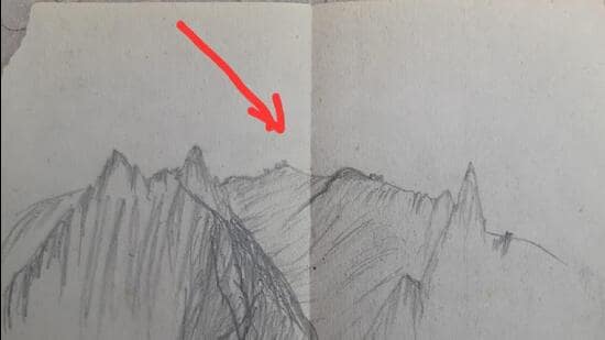
“So, by relying on field observations under fire, sketches were a normal thing due to shortage of maps in the early days, up to, say, June 1, 1999. Not only me, the soldiers also made sketches on scraps of paper to indicate routes or ask for artillery fire! I have preserved a piece of paper, 2 x 2.5 inches. It was a sketch made during the war by one of my JCOs, Sub. Dinesh or Sub. Nakul, asking for artillery fire on a Pakistani bunker he had seen. On the basis of that sketch, I was able to figure out the bunker location and I coordinated with Artillery officers. The Artillery Observation Post (OP) officer, Maj Dhingra, and the gun position officer were extremely responsive and patient while responding to our requisition for sketch-directed artillery fire. The JCO, who had made the sketch, was observing artillery rounds falling near that bunker and gave me corrections on radio. That enabled us to finally blast the bunker!” Brig Amul Asthana, then officiating CO, 1/11 Gurkha Rifles, operating on the Yaldor axis in the extremely tough but under-reported Batalik LoC battles, told this writer.
Many years later, Asthana merely had to appeal to “Google Aunty”. Using a Google Earth map of the Batalik sector, he managed to locate the position of the bunker blasted with the help of a plain sketch created on a scrap of paper by an unassuming Gurkha subedar with no pretensions whatsoever to Picasso!
Trees save
Trees are avowed as unconditional lovers of humanity, distributing shade even to the sweating woodcutter. Trees play a champion’s role in jungle life. Can fallen trees be also hailed as saviours, were they acting as blocks to a trail marketed for “eco-tourism”?
Till a few years back, this trail at Siswan dam’s far side was barred to vehicles as the Punjab forests and wildlife department had wisely dug a trench at the road’s entrance to the jungle. Later, the trench was thoughtlessly filled to “upgrade” the trail to “eco-tourism vehicular access” and barbed wire fences erected to “protect” the trail from wild animals.
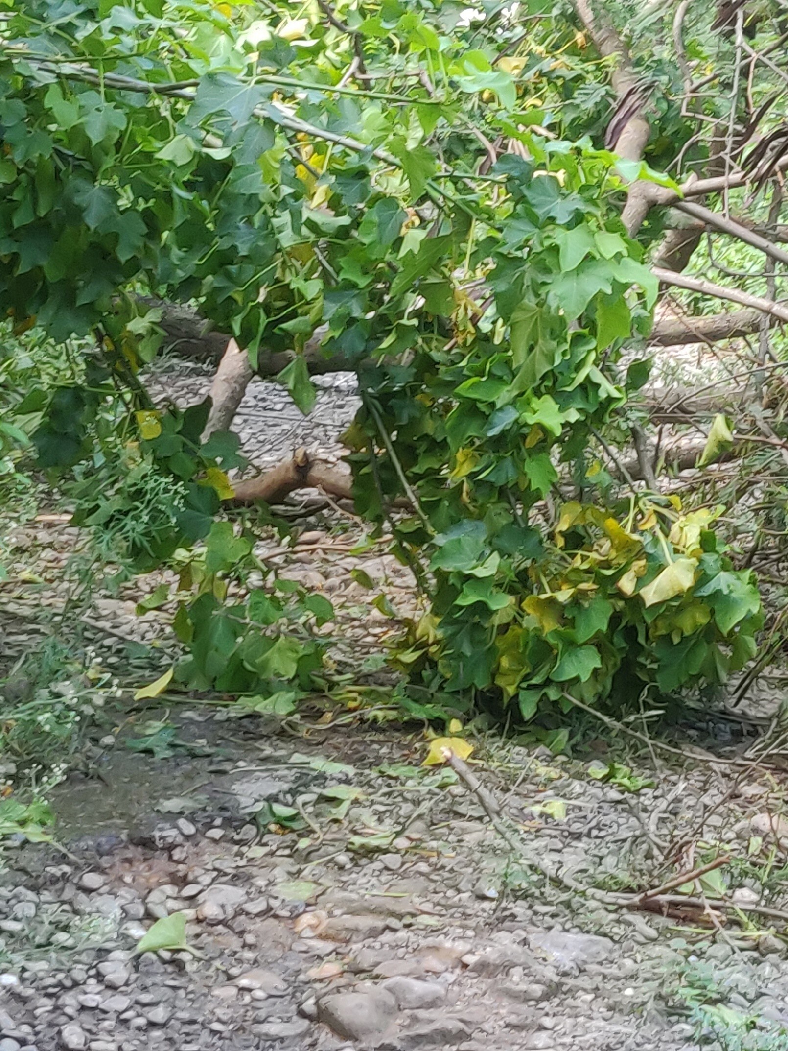
However, monsoon fury uprooted trees and that blocked the trail. A blessing in disguise as the trail was being misused by SUV adventurers, who disturbed wildlife and crushed micro-biodiversity. Poaching and the forest mafia posed a threat via vehicular access. “Love birds” and film crews would reach the dam’s back waters and litter freely. As were booze binges on bonnets and beer bottles left bobbing in pristine waters.


