
 E-Paper



Centre to use Isro satellites for pollution monitoring
A senior official of MoES said they are already working with Isro to identify stubble-burning hotspots


To better monitor pollution sources in northwest and central India and fix accountability on states contributing to high pollution levels, the ministry of earth sciences (MoES) in coordination with the ministry of environment will use satellite technology developed by the Indian Space Research Organisation (Isro) from next season, officials aware of the matter said on Friday.
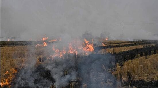
A senior official of MoES said they are already working with Isro to identify stubble-burning hotspots in the agrarian states of Punjab, Haryana and Uttar Pradesh. This project will, however, amplify the ambit of pollution monitoring to all sources.
“Through satellite imaging, we will identify hotspots for vehicular and industrial emissions, open burning, construction activities, etc. It will act as a real-time pollution map of the region using which we will be able to keep states accountable,” the official said, requesting anonymity.
The official added that the government is hoping to roll out satellite monitoring of the region before the next winter season and make this a uniform model to monitor pollution sources.
A document by the National Aeronautics and Space Administration (Nasa) explained that satellites can measure the concentration of aerosols in the atmosphere by observing how much light reaches the surface of the earth and how much is reflected off the aerosols. The measurement is called aerosol optical depth (AOD) or aerosol optical thickness. It is the same measurement that may have been made from the ground using a sun photometer.
“Using the following procedures, you can compare the satellite measurement of aerosol optical depth to the ground measurement from the sun photometer. You can also compare the satellite measurements with visibility or ozone concentrations to see the correlation,” the document said.
A senior Isro scientist said that currently, the space agency’s imager payload on board the INSAT-3D and 3DR satellites is used to monitor AOD and detect PM2.5 and PM10 concentrations in the atmosphere.
“INSAT 3D and 3DR imager-based AOD, PM2.5 and PM10 spatial maps are made available on web portals including airquality.iirs.gov.in and mosdac.gov.in along with other ancillary parameters for visualisation. Using medium resolution Indian Remote Sensing (IRS) satellite data, stubble burnt area maps are generated at the end of stubble-burning activity in kharif season,” the official said.

Stay updated with all top Cities including, Bengaluru, Delhi, Mumbai and more across India. Stay informed on the latest happenings in World News along with Delhi Election 2025 and Delhi Election Result 2025 Live, New Delhi Election Result Live, Kalkaji Election Result Live at Hindustan Times.


