
 E-Paper



SAFAR plans street-level forecasting for more accurate info on pollution
Street-level modelling would allow it to take into account all those local aspects, which play important roles in either pushing up or bringing down pollution levels


Hopefully by next winter, Delhiites would be able to receive more accurate pollution forecasts compared to what they get now.
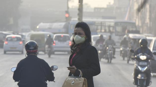
Handicapped by its present pollution forecasting models that are unable to track sudden changes in local weather patterns and emission sources, SAFAR – India’s official pollution forecasting system under the union ministry of earth sciences – is now planning to come up with street-level modelling for better forecasts.
“Street-level modelling would allow us to take into account all those local aspects, which play important roles in either pushing up or bringing down pollution levels. These may include the city’s skyline and its skyscrapers, vehicular traffic on roads, the city’s terrain including forests and water bodies, the wind tunnels available within highly congested areas among others,” said Gurfan Beig, project director of SAFAR.
For example, wind speed increases when the air hits a building and has nowhere to go. It is either pushed up, goes down or moves around the sides. The air forced downwards increases wind speed at the street level. The Venturi Effect, which increases the wind speed as the air is squeezed through a narrow space between two skyscrapers, can also flush out pollutants locally.
“For this, we would take the help of 3-D images available on Google earth. This would give us a fair idea of the streets and how air passes through a densely populated city like Delhi. We can have an idea of some major pollution sources such as dumping sites and most polluted streets,” he added.
Such modelling systems are available in some developed countries, including the US and UK, where they are also used to predict how water would flow through the city’s streets during flash floods. In USA, it was launched in 2016 by the National Oceanic and Atmospheric Administration.
“Our present forecasting system doesn’t allow us to zoom in on sudden localised weather developments or changes in local pollution sources. The models rely on the general parameters such as temperature, wind patterns, relative humidity and established pollution sources among others. We cannot zoom in below 1.5 km X 1.5 km. This is despite the fact that we are relying on the best available modelling system,” he said.
The result is that over the past few weeks even though SAFAR had forecast that pollution levels could shoot up, the levels had dropped many a times leaving the authorities red-faced.
“On Monday we had predicted that pollution levels could shoot up. But since Tuesday morning, suddenly the wind picked up and pollution levels went down. In the first week of November, we had forecast that pollution levels would shoot up. But we had no idea that it would shoot up to such severe levels. Local met conditions had played a vital role in aggravating the air quality,” he added.
Stay updated with all top Cities including, Bengaluru, Delhi, Mumbai and more across India. Stay informed on the latest happenings in World News along with Delhi Election 2025 and Delhi Election Result 2025 Live, New Delhi Election Result Live, Kalkaji Election Result Live at Hindustan Times.


