E-Paper



No cyclone ‘Arnab’, but rain threat stays: Deep depression crosses Andhra Pradesh coast
IMD officials had earlier clarified this weather system will not turn into a cyclone. However, intense showers were expected to persist till Thursday evening.

 Prefer HTon Google


The deep depression formed over the Bay of Bengal made landfall over Andhra Pradesh late on Wednesday night and is expected to move further inland – northwestwards, maintaining its intensity till Thursday evening, before it starts to gradually weaken by Friday night, the India Meteorological Department (IMD) has said.
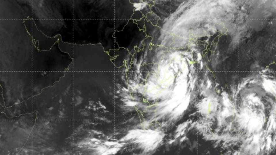
This is expected to bring intense, sustained localised showers, along with gusty winds up to 75 km/hr, the weather department has forecast. Track all updates on the deep depression here
Where is the deep depression
In its latest update, issued at around 7:30am on Thursday, the IMD said the deep depression was over the Andhra Pradesh coast and moved slowly west-northwestwards with a speed of 3 km/hr over the preceding six hours.
Deep Dive

“It crossed the coast close to southwest of Kalingapatnam between 11pm on September 23 and 1am on September – as a deep depression with maximum sustained wind speeds of 55-65km/hr gusting to 75km/hr,” said the IMD in its latest update, adding it continued to move west-northwestwards and was centred around 50km west of Kalingapatnam (Andhra Pradesh), 80km north-northeast of Visakhapatnam (Andhra Pradesh) and 170 kms southwest of Gopalpur (Odisha) at 5:30am on Thursday.
“It is very likely to move northwestwards initially maintaining intensity of deep depression for next 12 hrs. Thereafter it is very likely to move north-northwestwards and weaken gradually during subsequent 24 hours,” the IMD has said.
On IMD’s scale of tropical disturbances, a deep depression is one level above a depression, but one level below a full tropical cyclone. In a deep depression, the three-minute sustained wind speed is between 28-33 knots (52-61 km/hr).
No cyclone
IMD officials had earlier clarified this weather system will not turn into a cyclone. “However, we are expecting intense showers to still persist in the region till the end of Thursday,” said an IMD official.
Mahesh Palawat, vice president at Skymet meteorology, said the impact of the deep depression is also likely to be felt across northwest India by the weekend.
“Easterly winds and moisture are expected around Delhi NCR due to this deep depression. Thus, despite the withdrawal of the monsoon, we can expect some rain activity on Saturday and Sunday”, he said.