
 E-Paper


Delhi to map underwater terrain of Yamuna, Najafgarh drain
Technologies such as single- and multi-beam sonar, acoustic dopplers, GPS and motion sensors will be deployed to map the riverbed


The Delhi government will carry out a detailed topographic and bathymetric survey of the Yamuna stretch from Palla on the Delhi–Haryana border to Jaitpur on the Delhi–Uttar Pradesh border to map the river’s underwater terrain and identify clogged sections that may be contributing to flood risk, senior government officials said on Tuesday.
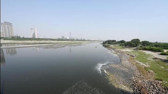
The study will also examine changes in the river’s cross-sections and course. The topographic survey will map all physical features within 100 metres of either bank, including embankments, spurs, drains, islands, ghats and encroachments.
A topographic survey charts natural and man-made features and their elevations to produce a comprehensive surface map. A bathymetric survey, meanwhile, uses sonar to measure depths and profile the riverbed, offering insights into drainage conditions and guiding future riverfront development and navigation projects.
Officials said similar surveys will also be carried out for the Najafgarh drain and its main tributary, the Supplementary drain.
On September 29, the irrigation and flood control (I&FC) department invited bids for the two surveys of the Yamuna. “The bathymetric survey will cover the entire 48km river course in Delhi, with cross-sections taken every 250 metres. The topographic survey will develop a contour plan of the river, track shifts in its course and record topographical changes. Both surveys will use electronic total station machines, eco sounders and sonar systems mounted on motorboats,” an official said.
Explaining the methodology, the official added, “Technologies such as single- and multi-beam sonar, acoustic dopplers, GPS and motion sensors will be deployed to map the riverbed. The sound velocity and sensor data will be processed using specialised software to generate a digital surface map.”
The two surveys on the Yamuna are expected to cost about ₹75 lakh, with the selected agency given eight months to complete the exercise. The I&FC department will also initiate bathymetric surveys in the Najafgarh and Supplementary drains at a combined estimated cost of ₹40 lakh.
The Najafgarh drain survey will be split into two phases: the first covering 20km from the Old Kakrola Regulator to Basai Darapur bridge in west Delhi at a cost of about ₹19 lakh, and the second covering over 12km from Basai Darapur to Timarpur bridge in north Delhi at a cost of around ₹7 lakh. The Supplementary drain, which joins the Yamuna via the Najafgarh drain, will be surveyed from its origin to Rithala bridge.
Ravindra Ravi, a water expert and founding member of the People’s Resource Centre (PRC), said the focus should be on restoring ecological flow and tackling pollution in the Yamuna and Sahibi rivers, rather than on boats or dredging. “Dredging disrupts the natural scheme. Rivers are self-cleaning—floods clear waste and restore floodplains. Efforts should curb industrial effluents and sewage. A riverfront in dry stretches makes no sense. The Sahibi has been reduced to a nalla, and waste from Delhi and Haryana must be stopped. We need to address root causes, not push superficial solutions.”
Earlier this month, water minister Parvesh Verma announced plans for the first-ever dredging of the Yamuna riverbed and said the government would seek approval from the National Green Tribunal (NGT). The proposal aims to restore the river’s natural flow, ease pressure on regulator drains, and strengthen flood resilience in low-lying neighbourhoods.
Dredging, which involves removing silt, sludge and waste from a riverbed, is typically undertaken in smaller water bodies such as canals and lakes. It is generally discouraged in rivers due to ecological concerns, but officials said Delhi would seek special permission from the NGT to carry it out in the Yamuna.

Stay updated with all top Cities including, Bengaluru, Delhi, Mumbai and more across India. Stay informed on the latest happenings in World News along with Delhi Election 2025 and Delhi Election Result 2025 Live, New Delhi Election Result Live, Kalkaji Election Result Live at Hindustan Times.


