
 E-Paper



Winds clean up Delhi's air, mercury may rise from Tuesday
The minimum temperature is forecast to rise to around 12°C by Tuesday. The maximum will continue to rise now and can touch 30°C by Saturday


The Capital on Monday recorded its best air day in four months due to strong surface winds, which kept the temperature down for a second day in a row.
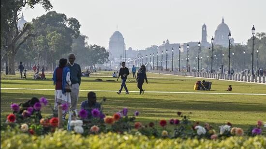
However, a drop in wind speed from Tuesday will lead to a gradual rise in temperature, according to India Meteorological Department (IMD), with forecasts showing the maximum is likely to hit 30°C by Saturday.
Delhi logged an Air Quality Index (AQI) reading of 135 (moderate) on Monday, according to the Central Pollution Control Board’s daily national bulletin — a slight improvement over the 175 (moderate) reading on Sunday. The last time Delhi had a lower AQI was on October 13, 2022, when it was 130.
Air quality forecasts by the Early Warning System (EWS) for Delhi, a model used by the Union ministry of earth sciences, shows that the air quality could return to “poor” by February 16.
Also read | Get ready for a warmer summer? Scientists say there’s a high probability of El Nino onset this year
“Delhi’s air quality is likely to improve further but will still remain in the lower end of the moderate category on February 14. The air quality is likely to deteriorate after that and will reach the upper end of the moderate category on February 15 and the poor category on February 16,” said EWS.
CPCB classifies an AQI between 0-50 as good, between 51 and 100 as “satisfactory”, between 101 and 200 as “moderate”, between 201 and 300 as “poor”, between 301 and 400 as “very poor”, and over 400 as “severe”.
Meanwhile, the maximum temperature at Safdarjung, which is representative of Delhi’s weather, was 23.2 degrees Celsius (°C) on Monday, which is around normal for this time of the year. In comparison, Delhi’s maximum temperature was 23.8°C on Sunday.
The city also recorded a minimum temperature of 8.7°C on Monday, two degrees below normal for this time of year, and lower than the 9.8°C on Sunday.
However, wind speed, recorded at 48kmph on Monday, is forecast to drop from Tuesday, which will lead to an increase in temperature, according to IMD.
Kuldeep Srivastava, scientist at IMD, said, “Much like Sunday, Delhi recorded strong winds between 9am and 5pm on Monday, which kept the temperature in check. The average wind speed was 20kmph with gusty winds touching 48kmph. From Tuesday onwards, we will see a slight drop in wind speed and some cloudiness, which will lead to a slight increase in temperature once again. The maximum will continue to rise now and can touch 30°C by Saturday.”
The minimum temperature is forecast to rise to around 12°C by Tuesday.
Another IMD official said the strong surface winds were occurring due to a strong northwest to southeast pressure gradient prevailing across the country – the greater the difference in pressure, the faster the wind flows from a high-pressure area to a low pressure one.
“An intense high pressure presently lies over southwest Rajasthan and adjoining areas of Pakistan. This pressure falls towards southeast of India towards the Bay of Bengal, creating a gradient from west to east. The wind direction is northwesterly, which is bringing some chill from the Himalayas, where fresh snowfall was received last week.” the official said.

Stay updated with all top Cities including, Bengaluru, Delhi, Mumbai and more across India. Stay informed on the latest happenings in World News along with Delhi Election 2025 and Delhi Election Result 2025 Live, New Delhi Election Result Live, Kalkaji Election Result Live at Hindustan Times.


