
 E-Paper



Heatwave in northwest India over next 2-3 days, says IMD
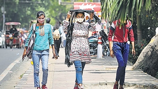
On Monday, Delhi recorded maximum temperature of 39.1 degree C, 7 degrees above normal at Safdarjung station.


There will be heatwaves across northwest India over the next 2-3 days, the India Meteorological Department (IMD) predicted on Monday, which is likely a result of scarce rainfall in March.
The rainfall deficit in March so far stands at 72% to 88% over northwest India, 85% over central India, 59% over east and northeast India, and 14% over the south peninsula, weather bureau data show. In its seasonal forecast on March 1, the met department had predicted normal rainfall (83%-117%) in March across the country.
Maximum temperatures have been 4°C to 6°C above normal in the past few days at many places in western Rajasthan, Jammu, Himachal Pradesh, Uttarakhand, Punjab, Haryana, Chandigarh, in some parts over Saurashtra and Kutch and at isolated places over western Madhya Pradesh and eastern Rajasthan.
On Monday, Delhi recorded maximum temperature of 39.1 degree C, 7 degrees above normal at Safdarjung station. Several other pockets in Delhi including Lodhi Road, Ridge, Ayanagar, Narela, Pitampura etc recorded over 40-degree C.
On Monday, Ajmer, Jaipur, Dholpur, Tonk, Bundi etc in Rajasthan recorded heat wave conditions with temperatures well over 40 degree C while Pilani, Bikaner, Churu, Ganganagar recorded maximum temperatures that are 7 to 9 degrees above normal.
Heatwaves are likely over western Rajasthan from March 28-30 and isolated heatwave conditions on March 1 and April 1, the weather department warned.
Isolated heatwaves are also likely over Jammu and Himachal Pradesh on March 28 and 29; over southern Haryana on March 29 and 30; over Saurashtra, Kutch, eastern Rajasthan and western Madhya Pradesh during March 28 to April 1; over Vidarbha, northern Madhya Pradesh, Maharashtra and Marathwada during March 29 and 31; over southern Uttar Pradesh on March 30 and 31; over Jharkhand and interior Odisha during March 30 and April 1.
A reason for the spike in temperatures was the hot wind blowing from southern Pakistan and Rajasthan, IMD director general M Mohapatra said.
“One of the reasons for very high temperatures is the rain deficit. But the wind direction over north India is presently also from the direction of South Pakistan and adjoining Rajasthan. These are very hot and dry regions,” Mohapatra said.
“There is a cyclonic circulation over the northern parts of Pakistan, which is also causing this wind pattern to persist,” he said. “We are expecting the wind direction to gradually change to northerly again in 2-3 days.”
The scanty rainfall in March is partly responsible for temperatures rising high so early this summer, said Mahesh Palawat, vice president of climate change and meteorology at Skymet Weather, a private forecaster.
“Sometimes, there is moisture incursion from the Bay of Bengal or Arabian Sea, which brings light showers and breaks the heat spell. That has not happened and we do not expect any weather system forming for the next 8-10 days,” Palawat said. “It will be a prolonged dry spell with high solar insolation due to clear skies.”
This summer from March to May, normal to above normal minimum temperatures are likely over many parts of northwest India, most parts of northeast India, some parts of central India, east coastal region and some areas along the foothills of the Himalayas, the IMD had forecast on March 1.
A heatwave is declared in areas where normal maximum temperatures are in excess of 40°C and the actual maximum temperature is between 4°C -5°C higher than normal. Heatwaves can also be declared when the maximum temperature remains above 45°C or more for a day, irrespective of normal maximum temperature.



