

 E-Paper


Earth at night
1 / 9

 View Photos in a new improved layout
Updated on Dec 06, 2012 01:55 pm IST
A combined NASA handout image shows the sun's innermost atmosphere as seen by the Solar Dynamics Observatory (SDO) inside a larger image provided by the Solar and Heliospheric Observatory spacecraft (SOHO) taken November 8-9, 2012. A coronal mass ejection can be seen traveling away from the sun in the upper right corner. (Reuters/ NASA)
2 / 9
 View Photos in a new improved layout
Updated on Dec 06, 2012 01:55 pm IST
This NASA image shows the United States at night. The image was made possible by the new satellite’s “day-night band” of the Visible Infrared Imaging Radiometer Suite (VIIRS), which detects light in a range of wavelengths from green to near-infrared and uses filtering techniques to observe dim signals such as city lights, gas flares, auroras, wildfires, and reflected moonlight. (AP Photo/NASA)
3 / 9
 View Photos in a new improved layout
Updated on Dec 06, 2012 01:55 pm IST
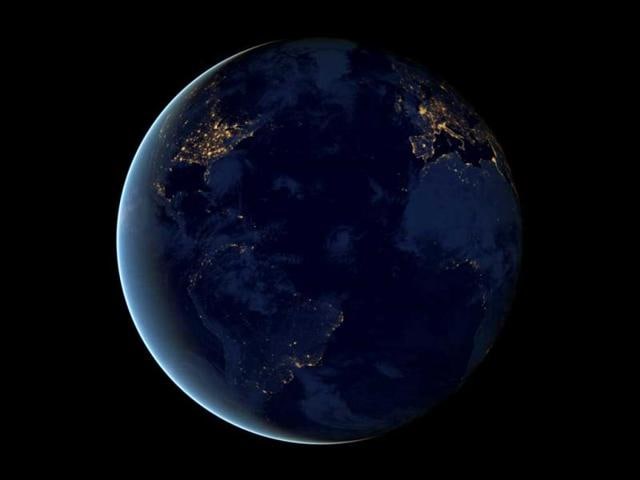
The night is nowhere near as dark as most of us think. This NASA image shows the city lights of earth at night. The new data was mapped over existing Blue Marble imagery of Earth to provide a realistic view of the planet. (AP Photo/NASA)
4 / 9
 View Photos in a new improved layout
Updated on Dec 06, 2012 01:55 pm IST
Away from human settlements, light still shines. This image provided by NASA shows Great Britain, Ireland, and part of northwestern Europe, including France, Belgium and the Netherlands, as they appeared on one of the March nights. (AP photo/ NASA)
5 / 9
 View Photos in a new improved layout
Updated on Dec 06, 2012 01:55 pm IST
A NASA Earth Observatory image shows the area near the Nile River valley and delta on the night of October. The image was acquired by the Visible Infrared Imaging Radiometer Suite (VIIRS) on the Suomi NPP satellite. This image was acquired near the time of the new Moon, and little moonlight was available to brighten land and water surfaces. (Reuters/ NASA)
6 / 9
 View Photos in a new improved layout
Updated on Dec 06, 2012 01:55 pm IST
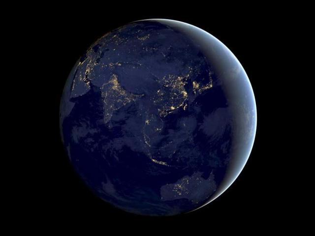
A NASA handout shows a composite image of Asia and Australia at night, assembled from data acquired by the Suomi NPP satellite. The image has been brightened to make the city lights easier to distinguish. (Reuters/NASA)
7 / 9
 View Photos in a new improved layout
Updated on Dec 06, 2012 01:55 pm IST
A NASA Earth Observatory image shows part of the Atlantic coast of South America on the night of June 20, 2012. The image was acquired by the Visible Infrared Imaging Radiometer Suite (VIIRS) on the Suomi NPP satellite. (Reuters/ NASA)
8 / 9
 View Photos in a new improved layout
Updated on Dec 06, 2012 01:55 pm IST
This NASA image from a composite assembled from data acquired by the Suomi NPP satellite shows the earth's city lights at night. (AP Photo/ NASA)
9 / 9
 View Photos in a new improved layout
Updated on Dec 06, 2012 01:55 pm IST