E-Paper


FEMA removed buildings from Camp Mystic flood hazard maps before July 4 disaster: Report
Records reveal FEMA repeatedly granted Camp Mystic’s appeals to remove buildings from flood hazard zones, years before the deadly floods killed 27.

 Prefer HTon Google


New evidence shows that Camp Mystic, the Texas girls’ summer camp where 27 campers and staff died after deadly flash floods on July 4, had successfully appealed to the Federal Emergency Management Agency (FEMA)for the removal of dozens of its buildings from 100-year floodplain maps which paved way for expansions in a known flood-prone area, reported CBS.
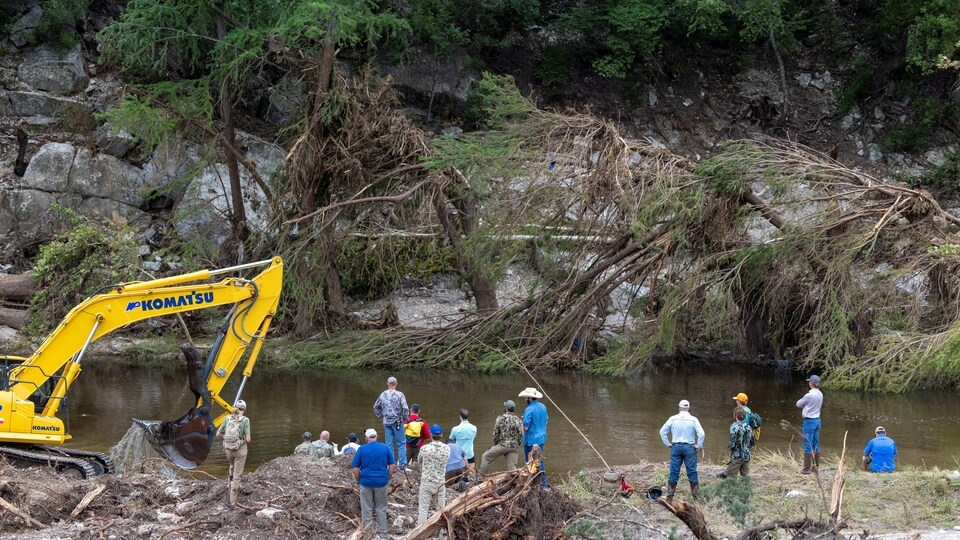
The tragedy at Camp Mystic occurred when the Guadalupe River in Kerr County rose to record levels during the early morning hours on July 4, inundating cabins, sweeping away buildings, and catching many sleeps with no warning. The disaster has triggered widespread questions about regulatory oversight, floodplain mapping, and emergency alert failures.
Camp Mystic floods: Buildings removed from FEMA Flood zone maps
In 2011, FEMA had designated over 30 buildings at Camp Mystic within a Special Flood Hazard Area which required stricter construction regulations and mandatory flood insurance. But camp officials appealed and in 2013, FEMA removed 15 buildings, all located on the original 99-year-old campgrounds now devastated by the floods, the CBS report added.
Further appeals led FEMA to remove 15 more buildings in 2019 and 2020 at Camp Mystic Cypress Lake, a new sister site which suffered less damage. These changes allowed for significant expansion, including new cabins, a chapel, and recreational spaces.
At least 12 buildings in the main camp, despite FEMA’s designation, were still within the floodplain during the flash floods, data from First Street Foundation showed, according to another New York Post report. Sarah Pralle, flood policy researcher at Syracuse University, told the Post that it is disturbing that “a camp responsible for so many children was allowed to bypass basic flood regulations”.
Camp Mystic floods: Motives behind map appeals
Experts believe the map amendments were likely pursued to avoid expensive flood insurance premiums and to enable new construction with fewer regulatory hurdles. Pralle, as per NY Post, noted that FEMA approved about 90 per cent of appeals which often benefitted wealthier or well-connected communities.
Pralle added, “Some exempted structures were within just two feet of FEMA’s flood zone, leaving no margin for safety.”
A 2021 study co-authored by Pralle found such amendments were more common in areas with high property values, newer buildings, and majority-white populations.
Also Read: Donald Trump calls reporter ‘evil’ when asked about lack of warnings before Texas floods
Warning system failure adds to tragedy
In addition to regulatory concerns, the CBS report stated, Kerr County failed to use its emergency alert system which could have warned residents and campers as floodwaters rose rapidly. While the National Weather Service issued alerts beginning at 1:14 am local time, the local government did not activate sirens or mobile alerts which was confirmed by fire department radio traffic reviews by CBS.
Kerr County Judge Rob Kelly admitted that the area does not have a warning system and by the time it appeared on social media around 5.15 am, the damage was already catastrophic.
FEMA and local officials under scrutiny
The NY Post stated that FEMA has since said the flood maps are ‘snapshots in time’ and not precise predictions, adding that they show minimum standards for risk assessment. However, climate models from First Street suggested both the original and expanded camps were at risk during a 100-year flood, contradicting FEMA’s amendments.
Meanwhile, Camp Mystic and local officials have not responded to news publications, but in an earlier statement called the event an “unimaginable tragedy”.
FAQs
What is a 100-year floodplain?
It’s an area with a 1 per cent annual chance of flooding. FEMA uses this to enforce regulations and insurance requirements.
Why were Camp Mystic buildings removed from the flood zone?
The camp appealed FEMA’s designation, likely to reduce insurance costs and allow expansion with fewer restrictions, as per NY Post.
Did Camp Mystic have a flood warning system?
No. Kerr County did not activate its CodeRED alert system or have sirens in place during the flooding.