
 E-Paper



‘Cold day’ conditions likely over many parts of northwest India
In Delhi, the maximum temperature was 16.2 degrees Celsius, 3.8 degrees below normal on Mondayl. Day temperatures are likely to fall further on Tuesday


Minimum and maximum temperatures have started to reduce in many parts of northwest India.
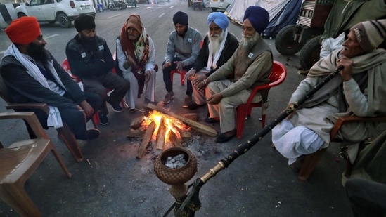
Due to dry north or northwesterly winds, the minimum temperature is very likely to gradually fall by 2-4 degrees Celsius over most parts of northwest India during the next 3-4 days which is likely to cause “cold day”/ “severe cold day” conditions in many pockets of Punjab, Haryana, Chandigarh, Delhi, northwest Uttar Pradesh and north Rajasthan during the next three days and “cold wave”/ “severe cold wave” conditions in pockets over Punjab, Haryana, Chandigarh, Delhi, northwest Uttar Pradesh and north Rajasthan during the next 3-4 days.
Also Read: At 23.5° C, Mumbai records highest minimum temp in January since 2011
Strong surface winds (with speed 15-25kmph) are very likely over the plains of northwest India during the next two days.
On Monday, in Chandigarh, the maximum temperature was 12 degrees Celsius, 8.4 degrees below normal; Rohtak 13.5 degrees Celsius, 6 degrees below normal; Bathinda 14.4 degrees Celsius, 6.5 degrees below normal. In Delhi, the maximum temperature was 16.2 degrees Celsius, 3.8 degrees below normal. Day temperatures are likely to fall further on Tuesday.
According to IMD, a “cold day” or “severe cold day” is considered based on two parameters—a minimum temperature of under 10 degrees Celsius and maximum temperature that is 4.5 degrees Celsius or 6.4 degrees below normal respectively. A “cold wave” occurs in plains when the minimum temperature is 10 degrees Celsius or below and/or is 4.5 notches lesser than the season’s normal for two consecutive days. Cold wave is also declared when the minimum temperature is less than 4 degree Celsius in the plains. Witnessing a cold day and cold wave together means the gap between day and night temperatures was lower than normal.


