
 E-Paper



Max temp at 44.7°C, IMD issues yellow alert
The department has predicted that similar conditions are likely to continue till next Tuesday, and has issued an IMD has issued an orange alert for Thursday


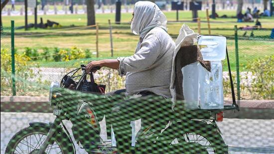
Hot, dry westerlies swept through Delhi on Wednesday, leading to a maximum of 44.7 degrees Celsius (°C) in the Capital, with heatwave or heatwave-like conditions in several parts of the city, India Meteorological Department (IMD) officials aware of the matter said.
IMD defines a “heatwave” in a region where the maximum temperature is over 40°C, and 4.5°C above normal, or when the actual maximum temperature reaches 45°C or more for two consecutive days. This becomes a “severe heatwave” when the maximum is 6.5°C above the normal.
The department has predicted that similar conditions are likely to continue till next Tuesday, and has issued an IMD has issued an orange alert for Thursday.
“An orange alert has been issued for Thursday and yellow alert for the following days. There had been some isolated places where a heatwave was observed in the past three days but on Wednesday, a lot of places recorded a heat wave and the severity of the heat wave was more as well. The following days are expected to be partly cloudy. The heatwave will continue as well, accompanied by strong surface winds,” said a senior IMD official.
Westerly winds, coupled with a lack of cloud cover, resulted in a maximum temperature of 44.7 degrees Celsius (°C) at Safdarjung, Delhi’s base weather station — five notches above normal for this time of the year. However, the reading at Safdarjung did not qualify as a heatwave because the city had logged a high of 43.8°C the day before.
At least four other weather stations in the city, however, recorded a severe heatwave — Najafgarh recorded a maximum of 47.7°C (8°C above normal), Narela recorded a maximum of 47.5°C (8°C above normal), while Pusa recorded a maximum of 46.5°C and Pitampura recorded a high of 46.7°C, the latter two 7°C above normal. Three more stations logged a heatwave — Palam, Ridge and Jafarpur.
The minimum on Wednesday also went up marginally and was 28.5°C, one degree above normal, and slightly above the 28°C a day before.
Mahesh Palawat, vice president of Skymet, said, “The dry westerlies will continue for at least a week. The heat wave conditions will continue as well. There might be some respite in the later part of next week but the forecast might change as well.”
Meanwhile, Delhi’s air quality remained in the poor category on Wednesday. The air quality index (AQI) was recorded at 211 (poor) at 4pm, according to the Central Pollution Control Board’s daily national bulletin. The AQI was 221 (poor) a day before.
The Air Quality Early Warning System for Delhi has forecast Delhi’s air to stay in the poor category till June 15.
“The air quality is likely to be in poor category from June 13 to June 15. The outlook for subsequent six days is that the air quality is likely to be in poor to moderate category,” AQEWS said in their bulletin on Wednesday.

Stay updated with all top Cities including, Bengaluru, Delhi, Mumbai and more across India. Stay informed on the latest happenings in World News along with Delhi Election 2025 and Delhi Election Result 2025 Live, New Delhi Election Result Live, Kalkaji Election Result Live at Hindustan Times.


