
 E-Paper



‘Severe cold’ grips Delhi, temperature 10° below normal
IMD has also issued a ‘cold day’ warning in Delhi for Tuesday and Wednesday, which means the day temperature will be at least 4.4°C below normal.


The difference between the maximum and minimum temperatures in Delhi narrowed to less than three degrees Celsius on Monday, which India Meteorological Department (IMD) classified as a “severe cold day” and the coldest December day in the last 16 years.
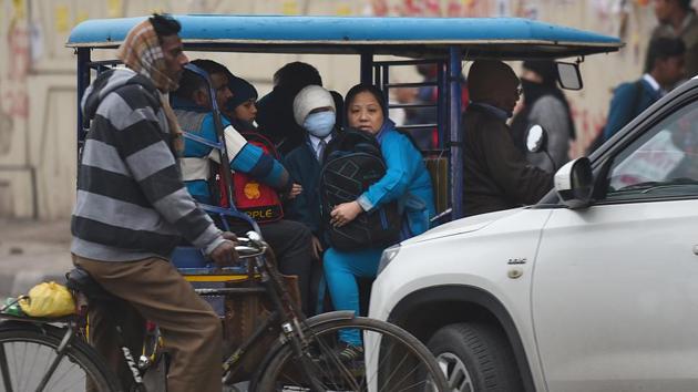
This means that the day, with chilly winds and overcast skies, was nearly as cold as the night.
On Monday, the maximum temperature in Delhi was 12.9 degrees Celsius, 10 degrees below the season’s normal, making it this season’s coldest day. The minimum temperature dropped to 10.2 degrees Celsius, two degrees above normal. Very light rain and thunderstorm is expected in the city on December 22 due to a likely western disturbance, IMD said.
IMD has also issued a ‘cold day’ warning in Delhi for Tuesday and Wednesday, which means the day temperature will be at least 4.4°C below normal. The unusually cold conditions have made the first half of December this year the coldest in at least 20 years, IMD scientists said.

The previous record for such a cold day in December was in 2003, when the maximum temperature dropped to 12.3 degrees Celsius on Christmas day. The lowest December day temperature was recorded on December 28, 1973, when the mercury touched 11.2 degrees Celsius, according to data from IMD’s National Weather Forecasting Centre (NWFC).
According to IMD, a “severe cold day” is registered when two things happen — the minimum temperature drops to less than 10 degrees Celsius and the maximum temperature is at least 6.4 degrees Celsius below normal.
Several parts of Haryana, north Rajasthan and Punjab also experienced “severe cold days” on Monday, IMD said.
In Delhi, though the minimum temperature on Monday at Safdarjung was 10.2 degrees Celsius, at least two other stations in the Capital recorded 9.5 degrees Celsius. The maximum temperature on Monday had a deviation of 10 degrees below normal.
IMD scientists said that despite a layer of fog and no sunlight, strong and cold winds helped improve the air quality to the ‘moderate’ category once again. On Monday, Delhi’s air quality index (AQI) was 185, as against 213 in the ‘poor’ zone on Sunday.
“The average wind speed was 15-20kmph. Delhi has been getting very cold and strong winds from the western Himalayan region, which has remained consistent for more than 20 hours, which irrespective of other factors clears out pollutants,” said Kuldeep Srivastava, head, IMD’s regional weather forecasting centre (RWFC).
Meteorologists attributed the unusually cold conditions to the western disturbance (WD) that brought heavy snowfall in the Himalayan region — Uttarakhand, Jammu and Kashmir and Himachal Pradesh — and rainfall across the northern plains, including in Delhi on December 12 and 13.
Following the WD, the winds are now north-westerly with a higher northerly component, which means that the winds are bringing in the extreme cold from Himalayas to the northern plains. “Severe cold” days are likely to continue over Punjab, Haryana, Chandigarh, Delhi, western Uttar Pradesh and north Rajasthan for at least another day, IMD said.
“The WD had also left moisture in the air which led to a dense layer of fog in most of the northern plains including Punjab, Haryana, Chandigarh and Uttar Pradesh except Delhi, where fog was moderate. When the fog lifted up a bit, it turned into low clouds shrouding the entire region. This didn’t allow sunlight to pierce through,” said Srivastava.
RK Jenamani, senior scientist at IMD’s NWFC, said, “We have observed a low cloud layer. It is covering the entire region. The clouds are hanging at a height of 500 to 800 metres from the surface. There was large-scale snowfall in the hills which is responsible for the chill. The interesting thing is our days now are almost as cold as our nights.”
Another WD is likely to affect western Himalayan region from December 18, which is likely to cause isolated to scattered rain or snow over the region. This is not likely to cause any significant weather changes over the plains, IMD’s Monday bulletin said. It will be the third WD in December. On average, two or three WDs affect the northern region in December.

Stay updated with all top Cities including, Bengaluru, Delhi, Mumbai and more across India. Stay informed on the latest happenings in World News along with Delhi Election 2025 and Delhi Election Result 2025 Live, New Delhi Election Result Live, Kalkaji Election Result Live at Hindustan Times.


