
 E-Paper



Sunny day in Delhi brings relief, IMD forecasts rain
According to India Meteorological Department (IMD), the wind direction changed from north-westerly (which brought cold winds from the Himalayas to the northern plains) to easterly (which brings moist air from West Bengal, Bihar, etc, originating in Bay of Bengal) on Tuesday, leading to a rise in the minimum temperature on Tuesday morning.


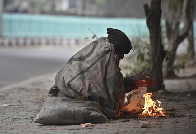
The day temperature in Delhi rose on Tuesday – after reaching an all-time low of 9.4°C the previous day – as a change in wind direction abated the severe cold spell impacting north India for nearly a fortnight in what was the second-coldest December recorded in the Capital since 1901.
According to India Meteorological Department (IMD), the wind direction changed from north-westerly (which brought cold winds from the Himalayas to the northern plains) to easterly (which brings moist air from West Bengal, Bihar, etc, originating in Bay of Bengal) on Tuesday, leading to a rise in the minimum temperature on Tuesday morning.
The minimum temperature at Delhi’s Safdarjung observatory was 4.8 degrees Celsius, 2 degrees Celsius below normal on Tuesday morning, compared to 2.6 degrees Celsius on Monday morning.
“When the wind direction is changing, winds are calm, creating conditions conducive for fog formation, which is why we saw very dense fog on Monday. Today, after the change in the wind direction, there was shallow fog all over north India. We are expecting the cold spell to abate from Wednesday,” said Kuldeep Srivastava, head of the Regional Weather Forecasting Centre.
The maximum temperature at the Safdarjung observatory, which is the official marker for the Capital, on Tuesday was 14.7 degrees Celsius, 5 degrees warmer than the maximum temperature on Monday. Tuesday was categorised to be a “cold day”, making it the 18th consecutive day Delhi has been reeling under a cold spell. This year, Delhi has recorded the longest cold spell since 1992, the year when cold spell records began being maintained. In December 1997, there was a 17-day cold spell and a 13-day cold spell in January 1997.
IMD defines a “cold day” as when maximum temperature is at least 4.5 notches below normal.
Delhi’s mean maximum temperature for December stood at 18.76 degrees Celsius, the second-lowest since 1901 after 17.3 degrees Celsius recorded in December 1997. “Only four times the mean maximum temperature for December has remained equal to or less than 20 degrees Celsius – 1919, 1929, 1961 and 1997,” IMD said.
Srivastava said: “Due to strong easterly winds of about 14 to 15 kmph prevailing over Delhi and NCR since 6pm on Monday, dense fog was prevented. These winds also reduced the thick layer of low clouds over northwest India and allowed sunlight to reach the surface which helped increase the maximum temperature on Tuesday.”
The air quality index on Tuesday was 387 in the “very poor” category, compared to 446 in the “severe” category on Monday.
The minimum temperature on Tuesday in Hisar was 4.5 degrees Celsius, 2.2 degrees in Mount Abu, 3.4 degrees in Bahraich, 3.8 degrees in Bhatinda and 4.6 degrees Celsius in Ambala, indicating a marginal improvement in night temperatures compared to previous days.
On Monday, severe cold day conditions were observed in most pockets over Punjab, Haryana, Chandigarh, Delhi, Uttar Pradesh and Bihar, and in isolated pockets over Jammu and Kashmir, Uttarakhand, north Rajasthan and north Madhya Pradesh.
“Fog condition has drastically improved over Punjab, Haryana, Chandigarh, Delhi, north Rajasthan, north Madhya Pradesh and West Uttar Pradesh. Under the influence of low level easterlies, dense fog conditions are unlikely to prevail over these regions during next 4-5 days,” IMD said. “Under the influence of the westerly trough and interaction with lower level easterlies, scattered to fairly widespread rainfall accompanied with thunderstorms, lightning and hail is also likely in major parts of northwest and Central India during January 1 and 4 and over east India during January 2 and 4, 2020,” it added.


