
 E-Paper



IMD prediction way off mark in cold December
It isn’t Delhi alone. All of north India, including Punjab, Haryana and Uttar Pradesh, has been reeling under a cold spell.


In November, the India Meteorological Department forecast a warmer than normal winter (December to February) in most parts of India. The weather office, which uses the Monsoon Mission Coupled Forecasting System (MMCFS) model for its seasonal forecasts, said there was a relatively “high probability” of above normal minimum temperatures in the so-called core cold wave zone, which includes Punjab, Himachal Pradesh, Uttarakhand, Delhi, Haryana, Rajasthan, Uttar Pradesh, Gujarat, Madhya Pradesh, and Jammu and Kashmir.
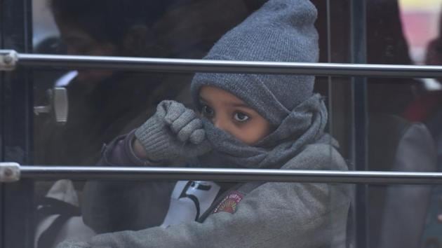
Ironically, it’s many of these, especially the northern plains and the northern states, that are experiencing cold weather. On Friday, for instance, Delhi recorded a minimum temperature of 6.4 degrees C, 2 degrees below normal and a maximum temperature of 17.5 degrees C, 5 degrees below normal (at the Safdarjung station). But meteorologists declared it a severe cold day in Delhi with the Palam station recording a minimum of 8 degrees C and a maximum temperature of only 15.4 degrees C, 7 degrees C below normal.
Already, till Friday, this week has seen four so-called “severe cold days”. According to IMD, a “severe cold day” is registered when two things happen — the minimum temperature drops to less than 10 degrees C and the maximum temperature is at least 6.4 degrees C below normal.
It isn’t Delhi alone. All of north India, including Punjab, Haryana and Uttar Pradesh, has been reeling under a cold spell.
So, did IMD get its forecast wrong?
Meteorologists said the average winter temperature may still be above normal despite extreme cold spells.
“These kind of spells can happen and go off. The forecast was for the entire December to February season. Even with these spells, the season’s average can be normal or above normal. Also, forecasts only indicate a trend,” said M Rajeevan Nair, secretary, ministry of earth sciences. “The spell we are seeing is typical of winter months with fog in the morning hours that doesn’t allow sunlight in so the maximum temperature or day temperature is very low. Such spells may happen again,” he added.
“It’s too early to say how average temperatures will be in north India this winter. It may be in the normal range. The seasonal outlook had indicated above normal winter temperatures more for central and peninsular India where we are expecting clouding and moisture incursion. For core cold wave zone also, it’s difficult to say now how January and February will turn out to be,” said Kuldeep Shrivastava, head, Regional Weather Forecasting Centre. Actually, IMD’s forecast specifically said winter would be warmer in the so-called core cold wave zone, in addition to central and peninsular India. The core cold wave zone comprises Punjab, Himachal Pradesh, Uttarakhand, Delhi, Haryana, Rajasthan, Uttar Pradesh, Gujarat, Madhya Pradesh, and Jammu and Kashmir.
It’s simply a matter of averages, another expert explained.
“IMD is talking about an average of three months up to February compared to the long term (1980 to 2010) average. There is a .5 degree C to 1 degree C warming in some pockets compared to that period. Within the slightly warmer winter you will have still have cold spells and warm spells,” said KJ Ramesh, former director general of IMD.
On Friday, severe cold day conditions were observed in most pockets over Haryana, Chandigarh, Delhi, Uttar Pradesh, Bihar, over East Madhya Pradesh and Punjab and in isolated pockets over West Uttar Pradesh, Jammu & Kashmir and Himachal Pradesh; cold day conditions in some pockets over North Chhattisgarh. Similar conditions are likely to continue during next 24 hours, IMD’s evening bulletin said. Cold wave conditions are also expected over East Uttar Pradesh, Bihar, Jharkhand, Odisha and Gangetic West Bengal on Saturday.
Meteorologists have attributed the unusually cold conditions to the western disturbance (WD), which brought heavy snowfall in the Himalayan region — Uttarakhand, Jammu and Kashmir and Himachal Pradesh — and rainfall across the northern plains, including in Delhi on December 12 and 13. There was higher moisture in the air because of the disturbance and cold winds blowing over the snow-clad mountains that brought cold air to the northern plains.
“That western disturbance has moved away now. But the rains left a lot of moisture in the atmosphere. There were very strong north-westerly, winds which brought cold winds from snow clad mountains. The combination [of the moisture] and the cold is causing dense fog. We had no sun for three days, naturally temperatures went down. We are expecting temperature to go up briefly because of an [other] approaching western disturbance. But the temperatures are so low already, we cannot say if it will make a noticeable difference,” K Sathi Devi, head of the National Weather Forecasting Centre, IMD said.
Air pollution levels also deteriorated to “severe” category on Friday, with meteorological conditions becoming unfavourable for dispersion of pollutants. The air quality index (AQI) on Friday was 432 and the ventilation index (a measure of the atmosphere’s ability to disperse pollutants) was less than 3000 sqm/second — the minimum required for dispersion is 6000 sqm/second, according to the ministry of earth sciences’ air quality early warning system.
“Low wind speed, dense fog, low temperature and high moisture accumulation all contributed to the deterioration in air quality. Pollutants become heavy when there is more moisture. The wind speed was less than 10kmph through the day,” said VK Soni, senior scientist at IMD at early warning system control room.
Air quality is unlikely to improve over the weekend, he added. “If there is only a drizzle, it may deteriorate further.”

Stay updated with all top Cities including, Bengaluru, Delhi, Mumbai and more across India. Stay informed on the latest happenings in World News along with Delhi Election 2025 and Delhi Election Result 2025 Live, New Delhi Election Result Live, Kalkaji Election Result Live at Hindustan Times.


