
 E-Paper



IMD issues red alert for parts of Tamil Nadu, Kerala
A red category warning implies that local authorities will have to take action to prevent disasters related to the extreme downpour.

 Prefer HTon Google


The India Meteorological Department (IMD) on Tuesday issued a red alert for three days in several parts of Tamil Nadu and Kerala and some areas of Karnataka which have been witnessing extremely heavy rainfall since Monday.
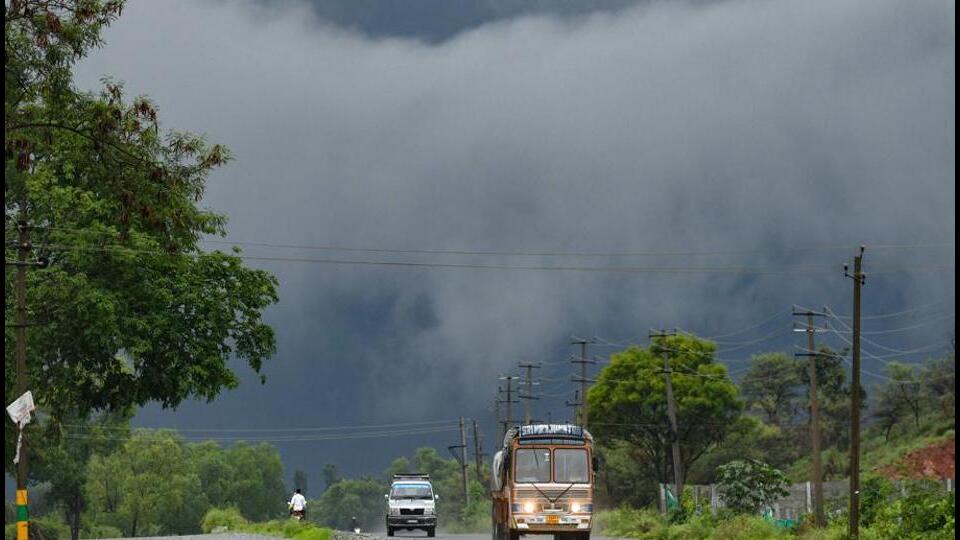
A red category warning implies that local authorities will have to take action to prevent disasters related to the extreme downpour.
“An east-west shear zone, that normally forms when there are weak monsoon conditions, has developed. The zone is formed when the easterly winds move to the north and the westerly winds to the south. There is an area of high convergence which sets up the platform for extremely heavy rainfall. Due to this, central and northern parts of Kerala will witness heavy rains for three days from Tuesday. Parts of Tamil Nadu will also receive very heavy rain,” IMD director general M Mohapatra said.
Also read: July ends with 8% excess rainfall but uneven distribution, says IMD
“The continuous rains can trigger landslides or mudslides in the hilly or ghat areas of the Western Ghats. People in these areas should take precautions to prevent any disaster,” he added.
The shear zone is running over south peninsular India in the middle tropospheric levels, according to the weather body. It is likely to shift gradually northward during the next four to five days.
Between Monday and Tuesday, Enamakkal in Kerala recorded 23 cm rainfall while Cochin International Airport, Kodungallur and Chalakudy logged 21 cm rainfall each, according to IMD data.
Aluva recorded 18 cm, Neriamangalam 17 cm and Peerumedu, Piravam, Ernakulam South, Perumbavur, Kollengode, Ambalavayal and Vilangankunnu 15 cm, respectively.
In Karnataka, Shirali Pto in Uttara Kannada recorded 29 cm rainfall while Subramanya in Dakshin Kannada recorded 22 cm. Karwar Obsy recorded 11 cm rain, the data showed.
LINE ON TAMIL NADU
Meanwhile, a north-south trough is also running from south Chhattisgarh to the Comorin area at lower tropospheric levels. The western end of the monsoon trough is lying north of its normal position and its eastern end is near its normal position, the IMD said.
The monsoon trough is likely to be near normal or south of its normal position from August 5 onwards. Under the influence of these systems, widespread rainfall with isolated heavy rain and thunderstorm or lightning are very likely over Rayalaseema and Lakshadweep from August 2 to 4, south Coastal Andhra Pradesh and Yanam on August 6 and over Telangana, Karnataka, Tamil Nadu, Puducherry, Karaikal and Kerala till August 6, the weather body said in its forecast.
Isolated very heavy rainfall is likely over south interior Karnataka on Tuesday and August 6, north interior Karnataka from August 4 to 6, Kerala, Mahe, Tamil Nadu, Puducherry and Karaikal on August 5 and over coastal Karnataka on August 6.
Isolated extremely heavy rainfall is also likely over Kerala, Mahe and adjoining Tamil Nadu till August 4, south interior Karnataka from August 3 to 5 and over coastal Karnataka from August 2 to 5.
Also read: Partly overcast weather, light rain, drizzle expected in Delhi today
Widespread rainfall with isolated heavy rain and thunderstorm/lightning are very likely over Konkan and Goa from August 4 to 6, Chhattisgarh, east Madhya Pradesh and madhya Maharashtra on August 5 and 6, and Vidarbha and Marathwada on August 6.
Isolated/scattered very heavy rainfall is expected over Konkan and Goa on August 5 and 6.
In the east and northeast, widespread rainfall with isolated heavy rain and thunderstorm/lightning is likely over Arunachal Pradesh and sub-Himalayan West Bengal and Sikkim on Wednesday, Odisha on August 5 and 6 and over Assam, Meghalaya, Nagaland, Manipur, Mizoram and Tripura till August 5.
Isolated very heavy rainfall is also very likely over Odisha on August 6, the IMD predicted.


