
 E-Paper



‘Normal’ monsoon likely in July but rains will revive only during second week
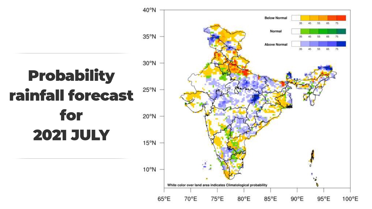
During July when most of monsoon rain is recorded normally, ‘below normal’ to ‘normal’ rainfall is likely over many areas of northwest India; parts of south peninsula, central, east and northeast India, India Meteorological Department (IMD) said in its forecast for July on Thursday


Monsoon rain in July is likely to be ‘normal’ between 94 to 106% of long period average (LPA).
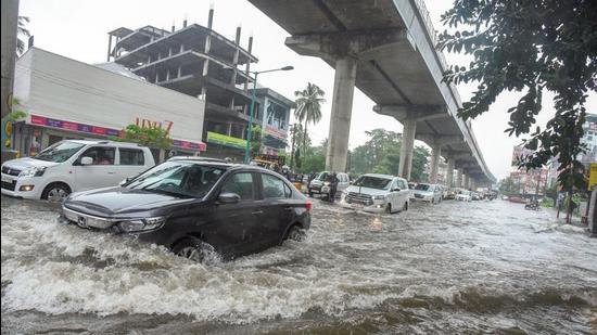
During July when most of monsoon rain is recorded normally, ‘below normal’ to ‘normal’ rainfall is likely over many areas of northwest India; parts of south peninsula, central, east and northeast India, India Meteorological Department (IMD) said in its forecast for July on Thursday.
‘Normal’ to ‘above normal’ rainfall is likely over parts of central India and adjacent areas of peninsular India and Gangetic plains in July.
The latest global model forecasts indicate that the prevailing neutral El Nino-Southern Oscillation (ENSO) conditions are likely to continue over the equatorial Pacific Ocean and that there is an enhanced possibility of development of negative Indian Ocean Dipole (IOD) conditions over the Indian Ocean during July to September period.
Also Read | HT Explainer: The monsoon is on a break. What does it mean?
“While neutral ENSO conditions don’t affect the monsoon, negative IOD conditions are not favourable to Indian monsoon. There is still a high probability of normal monsoon over the country during July,” said M Mohapatra, direct general, IMD.
As sea surface temperature (SST) conditions over the Pacific and the Indian Ocean are known to have strong influence on Indian monsoon, IMD is carefully monitoring the evolution of sea surface conditions over these ocean basins, it said in its statement.
Mohapatra said monsoon covered most parts of the country except parts of northwest India, including Haryana, Delhi, Punjab etc by June 19 but monsoon flow started weakening from June 26 onwards. Spatially monsoon coverage reduced significantly in the past two days and monsoon is unlikely to revive in the next 7 to 10 days, he added. “There is a chance that a low-pressure area will form over Bay of Bengal around July 11 or 12. There is no chance of monsoon picking up very much before that,” added Mohapatra.
IMD warned that subdued monsoon conditions will impact agricultural operations especially sowing and transplantation of crops in many parts of the country.
Scientists are expecting south-westerly winds from Arabian Sea are likely to affect the northwest region including Delhi in the next couple of days which is likely to abate heat wave conditions, but humidity will increase. This may lead to very uncomfortable conditions as the impact of heat will be accentuated with high humidity.



