
 E-Paper



Amarnath flood: No system to forecast cloudbursts, says IMD
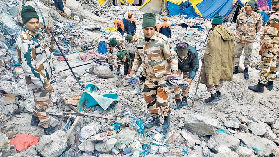
The resultant flashflood and landslides have claimed the lives of 16 persons and 40 are still missing. Authorities are continuing rescue operations and the pilgrimage has been halted for now.

 Prefer HTon Google


When the weather office in Srinagar predicted light rain around the Amarnath area on Friday, meteorologists had no way of anticipating the sudden cloudburst that dumped an enormous volume of water in the upper reaches that caused a flashflood and landslides, sweeping away the pilgrim camp below the cave shrine in an unprecedented tragedy in the remote region of the Himalayas.
The automatic weather station near the holy cave on Friday recorded no rainfall between 8.30am to 4.30pm, 3mm rain between 4.30pm and 5.30pm, and 28 mm between 5.30pm and 6.30pm. A total of 31mm rainfall in two hours does not qualify as a cloudburst, which is officially defined as 100mm or more in one hour.
“We suspect that the region above the Amarnath cave may have experienced a cloudburst, leading to highly intense and highly localised rainfall that our automatic weather station could not catch,” said Sonam Lotus, scientist at the weather bureau in Srinagar. “We have no means of measuring the rainfall there as it is very remote area.”
The resultant flashflood and landslides have claimed the lives of 16 persons and 40 are still missing. Authorities are continuing rescue operations and the pilgrimage has been halted for now.
Widespread rainfall with isolated thunderstorm or lightning is likely over western Himalayas in next five days, the weather office has forecast.
Last year, a similar incident had occurred in Honjar village of Jammu and Kashmir’s remote mountainous Kishtwar district following a cloudburst that killed seven people; several remain missing. Every July, cloudbursts and flashfloods in the Himalayas and the Western Ghats make headlines but forecasting such extreme weather events is fraught with challenges.
“Worldwide, there is no system to forecast cloudburst events. The modelling system often cannot catch how quickly these systems develop and how intense they are,” said RK Jenamani, scientist at the national weather forecasting centre of the Met department. “The accumulation of a lot of moisture in the mountain topography leads to such events. We know that such episodes are increasing in frequency as well.”
Climate change could be a reason for the increasing frequency of cloudbursts.
“We know that the moisture holding capacity of the atmosphere has increased due to climate change. During monsoons, this becomes even more pronounced, leading to cloudbursts or flashflood disasters,” said a former government meteorologist, who declined to be named.
“Increasingly we are seeing crowds at places that are already vulnerable to such events. A large number of people should not gather or change land use in a region which is vulnerable to extreme rainfall events,” he said. “Such events will not happen every year, but they can happen once in a few years.”
There has been a rise in mini cloudbursts along India’s west coast and along the foothills of the western Himalayas between 1969 and 2015, according to a report by the earth sciences ministry published last year.
“Extreme precipitation is projected to increase in major mountainous regions, with potential cascading consequences of floods, landslides and lake outbursts in all scenarios,” the Intergovernmental Panel on Climate Change, an authoritative panel of weather experts, said in a scientific report last year.
“We have to realise that the Himalayas are warming faster and more than peninsular India and other parts. In such a situation, extreme events will happen in the mountains more often,” said Anil V Kulkarni, visiting scientist at the Divecha Centre for Climate Change at the Indian Institute of Science.
“The other aspect of this development is that the Amarnath cave is at an altitude of over 4000 metres and extremely ecologically fragile,” Kulkarni said. “If there are too many people there, they may be vulnerable.”
The southwest monsoon has been active for the past one week, bringing widespread rain to west and central India. This also led to flooding over parts of Maharashtra, Gujarat and Telangana. There is 5% excess rainfall over the country with south peninsula recording 24% excess, central India 5% excess, northwest India 5% deficit and east and northeast India 1% deficit. There was an 8% rain deficit over the country at the end of June.
The monsoon on Sunday continued to remain active over the west coast and central India. An intense wet spell is likely to continue over Telangana, Vidarbha, adjoining areas of coastal Andhra Pradesh and south Chhattisgarh on July 10 and 12, and intense showers are likely over Gujarat, Konkan, Goa, Maharashtra and coastal Karnataka from July 12.
Widespread rainfall, thunderstorm and lightning is likely over Chhattisgarh, Vidarbha, Madhya Pradesh, Odisha, Maharashtra, Gujarat, Kerala, coastal Andhra Pradesh, Telangana and Karnataka in the next 4-5 days, the weather office predicted.
Heavy rainfall is likely over Uttarakhand between July 10 and 12, and scattered rainfall activity with isolated thunderstorm or lightning is likely over Punjab, Haryana, Chandigarh, Rajasthan and Uttar Pradesh in the next five days.
Isolated heavy rainfall is likely over Punjab on July 10, 12 and 13; Haryana and Chandigarh on July 13 and 14; western Rajasthan on July 10, and eastern Rajasthan during July 11 to 14. Isolated heavy rainfall is also likely over Haryana, Chandigarh and eastern Rajasthan on July 10.
The IMD plans to install at least 90 weather radars to be able to effectively forecast severe weather events, M Ravichandran, secretary, Ministry of Earth Sciences, had said last year.
“There are about 33 radars in IMD network and our objective is to at least have 90 radars to map the entire country,” he said.



