
 E-Paper



Delhi's Yamuna floodplain gets divided into two under 2047 plan; ‘regulated recreation’ to be allowed in O-2 zone
Delhi’s new 2047 master plan splits the Yamuna floodplain into O-1 and O-2, allowing regulated recreational activity in the outer buffer.

 Prefer HTon Google


The Yamuna floodplain, earlier treated as a single protected planning zone where development was largely restricted, has now been divided into two parts under the Master Plan for Delhi-2047, with a lower degree of protection proposed for a “buffer area” farther from the river, according to officials aware of the plan.
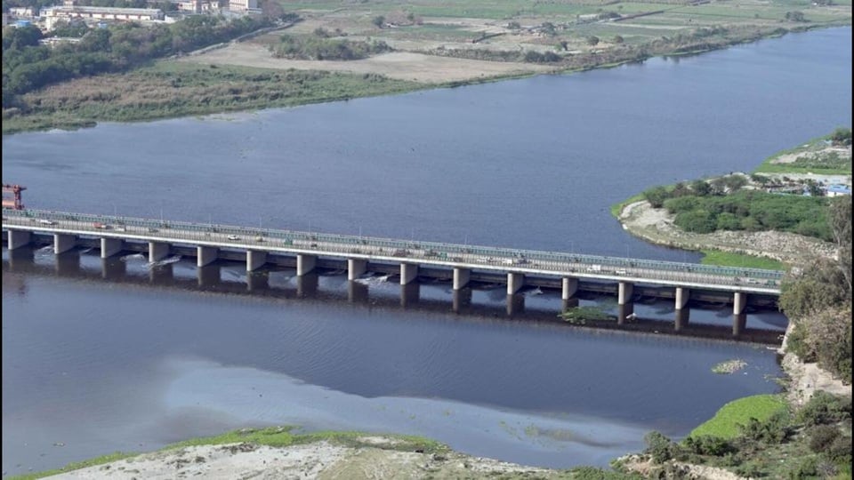
Under the new plan, the O-Zone, which broadly covers the Yamuna and its floodplain, has been divided into O-1 and O-2, HT has learnt. While no construction or development will be permitted in O-1 — which falls within the defined 1-in-25-year floodplain — O-2, the area outside this zone, will allow specified recreational activities, including parks and green spaces, subject to regulations, an official aware of the matter said.
Also read: DDA clears Delhi 2047 plan, opens door to development in 70 villages, parts of Yamuna floodplain
O-1 gets highest protection, O-2 allows regulated recreation
The change marks a departure from the approach outlined in the draft Master Plan for Delhi-2041 and previous master plans, which sought to protect the Yamuna floodplain as a whole and allowed only restricted development in areas under environmental protection.
The draft MPD-2041 had proposed that the Yamuna’s 1-in-25-year floodplain – a low-lying riparian zone with a 4% annual probability of flooding and designated as O-Zone by successive master plans – or any area subsequently delineated by a competent authority, would be included in the city’s database of green-blue infrastructure. It also envisaged a 300-metre-wide green buffer, wherever feasible, along the entire edge of the river.
The draft plan had specifically stated that “no permanent construction shall be permitted in the floodplain” and proposed public access through 75-100 metre-wide greenways along embankments, with cycling and walking trails and spaces for passive recreation.
Also read: DDA approves Master Plan Delhi 2047; 2041 deadline moved
The new plan, officials explained, creates a distinction between the “core floodplain” and the “outer buffer”. While O-1 continues to receive the highest level of protection, O-2 is no longer subject to the same blanket restriction and can accommodate regulated recreational uses.
Environmental concerns over development in buffer zone
This, officials explained, means areas that were earlier part of the larger protected O-Zone will now have a separate development regime. Although the proposed uses are recreational and regulated, environmental planners and residents have previously raised concerns over the impact that increasing activity and infrastructure in the floodplain could have on its ecological and flood-management functions.
Bhim Singh Rawat, coordinator of the South Asia Network on Dams, Rivers and People (SANDRP), said the Delhi Development Authority (DDA), which was made the custodian of the Yamuna floodplain, was instead working towards weakening the laws meant to protect it.
“On the one hand, DDA has been stalling scientific demarcation of floodplain in ongoing NGT cases for several years and now it is changing the very definition. The one-in-100-year flood should be the baseline, not 25-year flooding period. The last two flooding episodes have shown that even with smaller water discharges, the carrying capacity of the river in Delhi has been severely compromised,” he said.
Rawat said the urban development ministry should reject the proposal cleared by the DDA and set up an independent expert body to manage the floodplains. “DDA has first failed to protect the floodplains by allowing these unauthorised colonies to come up and now it is changing laws to hide its own failure. This is a clear recipe for disaster. We have weak laws in India which keep the ambiguity to protect river regulation zones and even these laws are not being followed,” he added.
Also read: Master Plan amendments: Floor area ratio norms to be decided on consultant’s report
DDA says plan aims to strengthen river-people connect
A senior DDA official, however, defended the approach, saying the proposal did not envisage unrestricted construction. “The idea is not to permit unrestricted construction, but to identify areas where regulated recreational activities can be undertaken without affecting the floodplain’s ecological and flood-management functions. The idea is to increase ‘river-people connect’ so that people care for and take responsibility for the river,” the official said.
Besides the buffer, the plan proposes restoration of wetlands by de-silting existing water bodies and converting natural depressions into “storage basins”. It also proposes strict monitoring to prevent illegal construction, dumping of construction waste and discharge of untreated sewage into the river.
Socio-cultural activities such as religious gatherings are to be confined to specifically earmarked locations, with regulations governing the disposal of pooja material, idol immersion, fertiliser use and garbage disposal.
Also read: New master plan to allow commercial development in 70 peripheral villages
Floodplain demarcation, court orders add to stakes
The proposed division comes as authorities continue work on the physical demarcation of the Yamuna floodplain and its cleaning. The National Green Tribunal (NGT) has directed agencies to expedite the ground-level demarcation exercise, which is based on flood levels and contour data.
The classification is also significant given the history of development pressure in the O-Zone. Several unauthorised colonies and settlements have come up in and around the floodplain over the years, prompting repeated action by civic agencies and courts. The Delhi High Court in May 2026 also directed authorities to prevent fresh construction there.
DDA has meanwhile undertaken ecological restoration projects along the Yamuna floodplain, including wetlands, biodiversity areas, native plantations and green spaces such as Baansera, Asita and Vasudev Ghat.
Also read: DDA plans major urban overhaul with 8-point development roadmap for Delhi
The controversy over unauthorised colonies in the O-Zone has intensified in recent months after agencies began putting up O-Zone marking boards following court orders. More than 300 notice boards and demarcation signs were installed in mid-2026, declaring several residential areas along the 22-km Yamuna floodplain stretch from Wazirabad to Okhla as part of the ecologically sensitive Zone O. The move triggered panic among residents and political clashes over the possibility of demolition.
Experts said the effectiveness of the new framework would ultimately depend on how narrowly “recreational activities” are defined, the extent of permanent infrastructure permitted for such activities and whether development in O-2 is prevented from affecting the floodplain’s natural drainage, groundwater recharge and flood-storage capacity.



Stay updated with all top Cities including, Bengaluru, Delhi, Mumbai and more across India. Stay informed on the latest happenings in World News along with Delhi Election 2025 and Delhi Election Result 2025 Live, New Delhi Election Result Live, Kalkaji Election Result Live at Hindustan Times.


